block by block
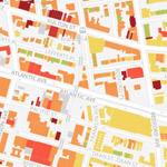
BKLYNR is a map that reveals the age of 320,000 buildings in Brooklyn.
The map reveals patterns of urban development and trends in development.
From the project description:
The borough’s a patchwork of the old and new, but traces of its history aren’t spread evenly. There are 320,000-odd buildings in Brooklyn, and I’ve plotted and shaded each of them according to its year of construction. The result is a snapshot of Brooklyn’s evolution, revealing how development has rippled across certain neighborhoods while leaving some pockets unchanged for decades, even centuries.